


VTD-precinct 11, Brookings County, South Dakota
About
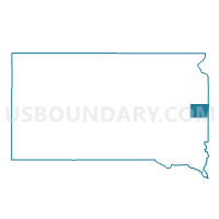
Outline

Summary
| Unique Area Identifier | 667019 |
| Name | VTD-precinct 11 |
| County | Brookings County |
| State | South Dakota |
| Area (square miles) | 104.54 |
| Land Area (square miles) | 104.45 |
| Water Area (square miles) | 0.09 |
| % of Land Area | 99.91 |
| % of Water Area | 0.09 |
| Latitude of the Internal Point | 44.28892630 |
| Longtitude of the Internal Point | -96.66027140 |
Maps


Graphs
Select a template below for downloading or customizing gragh for VTD-precinct 11, Brookings County, South Dakota


Neighbors
Neighoring Voting District (by Name) Neighboring Voting District on the Map
- VTD-precinct 1, Brookings County, SD
- VTD-precinct 10, Brookings County, SD
- VTD-precinct 13, Brookings County, SD
- VTD-precinct 16, Brookings County, SD
- VTD-precinct 4, Brookings County, SD
- VTD-precinct 4B, Moody County, SD
- VTD-precinct 5, Brookings County, SD
- VTD-precinct 8, Brookings County, SD
- VTD-precinct 9, Brookings County, SD
Top 10 Neighboring County Subdivision (by Population) Neighboring County Subdivision on the Map
- Brookings city, Brookings County, SD (22,056)
- Medary township, Brookings County, SD (1,427)
- Aurora town, Brookings County, SD (532)
- Brookings township, Brookings County, SD (431)
- Sterling township, Brookings County, SD (378)
- Aurora township, Brookings County, SD (294)
- Alton township, Brookings County, SD (228)
- Sherman township, Brookings County, SD (227)
- Afton township, Brookings County, SD (212)
- Richland township, Brookings County, SD (199)
Top 10 Neighboring Place (by Population) Neighboring Place on the Map
Top 10 Neighboring Unified School District (by Population) Neighboring Unified School District on the Map
- Brookings School District 05-1, SD (25,450)
- Deubrook School District 05-6, SD (1,902)
- Colman-Egan School District 50-5, SD (1,663)
- Elkton School District 05-3, SD (1,467)
Top 10 Neighboring State Legislative District Lower Chamber (by Population) Neighboring State Legislative District Lower Chamber on the Map
Top 10 Neighboring State Legislative District Upper Chamber (by Population) Neighboring State Legislative District Upper Chamber on the Map
Top 10 Neighboring 111th Congressional District (by Population) Neighboring 111th Congressional District on the Map
Top 10 Neighboring Census Tract (by Population) Neighboring Census Tract on the Map
- Census Tract 9589, Brookings County, SD (7,389)
- Census Tract 9590, Brookings County, SD (4,985)
- Census Tract 9587, Brookings County, SD (4,965)
- Census Tract 9586, Brookings County, SD (3,746)
- Census Tract 9596, Moody County, SD (3,313)